Friday, September 17, 2004I finished my class in Boulder on Thursday, and drove to southwest Colorado through Kenosha Pass (10,001 feet), Red Hill Pass (9,993 feet), and Cottonwood Pass (12,126 feet). I will probably have photos from Cottonwood Pass or Taylor Park Reservoir on here at some point. |
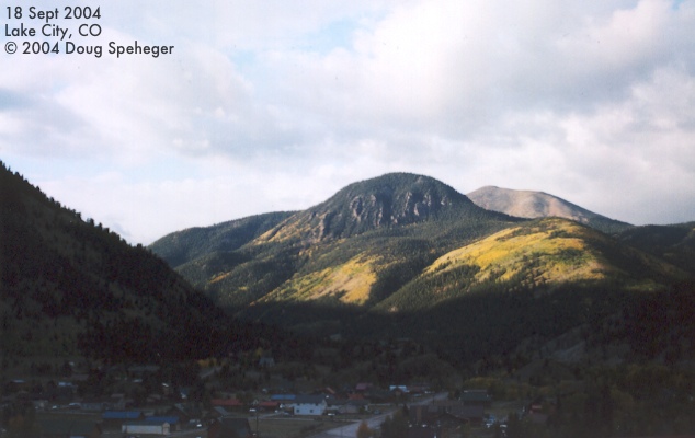
Saturday, September 18, 2004 We spent the night in Lake City and had this
view out of the motel room
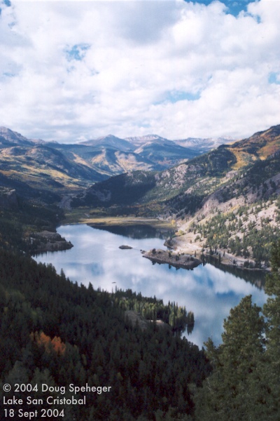
on Saturday morning. We drove southeast out of Lake City and explored near the
Lake San Cristobal overlook
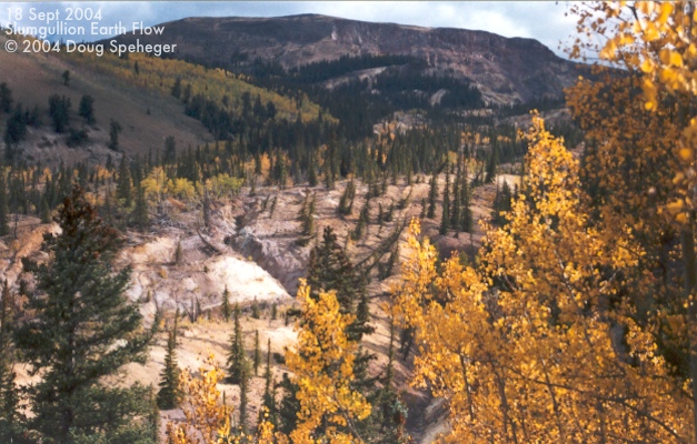
and the
Slumgullion Earth Flow.
The earth surface at areas of the Slumgullion Earth Flow is apparently still moving downhill
at the rate of about 20 feet per year. The trees in the middle of the photos at an odd
angle is beacuse of the push of this flow.
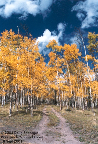
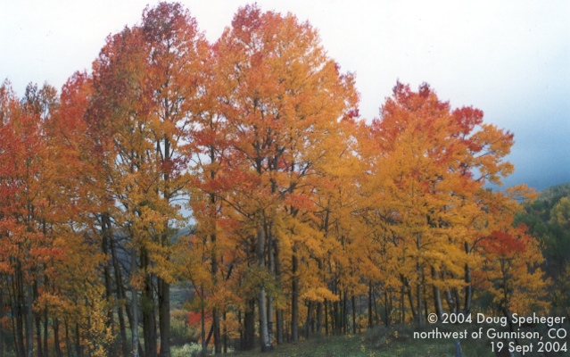
Continuing southeast, we encountered a nice grove of aspen trees in fall colors as seen
on the left and also
this photo.
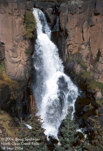
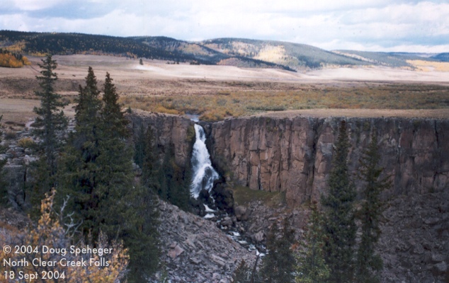
Surprisingly, there is a nice waterfall, the
North Clear Creek Falls,
in the area despite not realizing there is any flowing water of significance while driving
in the area. Here is a
wide view of the falls.
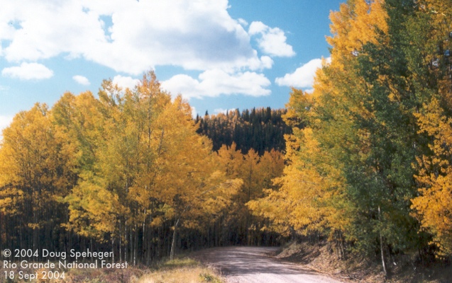
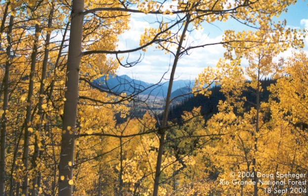
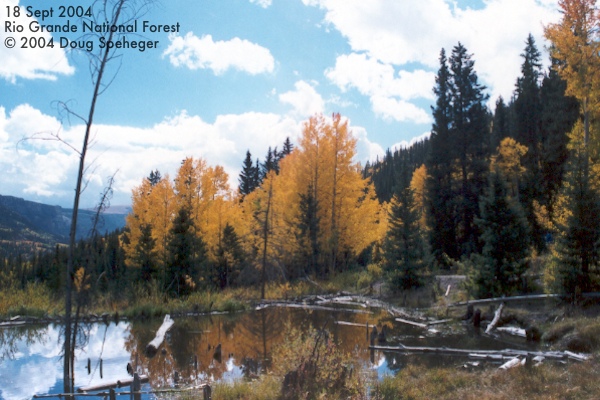
Down the road from the waterfall was another nice grove of aspen trees where these photos
were taken:
1,
2,
3,
4.
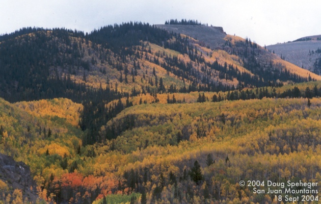
Here is a wide view
of various colors in the San Juan Mountains.
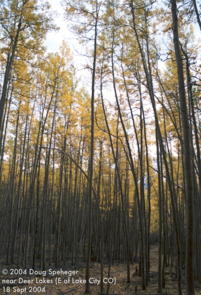
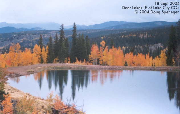
We finally did some hiking
through a grove of aspens
near
Deer Lakes.
We spent the night in Lake City and had this
view out of the motel room
on Saturday morning. We drove southeast out of Lake City and explored near the
Lake San Cristobal overlook
and the
Slumgullion Earth Flow.
The earth surface at areas of the Slumgullion Earth Flow is apparently still moving downhill
at the rate of about 20 feet per year. The trees in the middle of the photos at an odd
angle is beacuse of the push of this flow.
Continuing southeast, we encountered a nice grove of aspen trees in fall colors as seen
on the left and also
this photo.
Surprisingly, there is a nice waterfall, the
North Clear Creek Falls,
in the area despite not realizing there is any flowing water of significance while driving
in the area. Here is a
wide view of the falls.
Down the road from the waterfall was another nice grove of aspen trees where these photos
were taken:
1,
2,
3,
4.
Here is a wide view
of various colors in the San Juan Mountains.
We finally did some hiking
through a grove of aspens
near
Deer Lakes.
|
Sunday, September 19, 2004 The weather complicated things today as moisture was moving into Colorado from Pacific Hurricane
Javier and producing low clouds and occasional rain. So, no hiking today. But we took a
drive through areas north and west of Gunnison where we were able to see some nice colors
in the trees (despite the clouds and poor colors in the sky) such as the varied aspen
colors in the Ohio Creek area on the right and in
this photo.
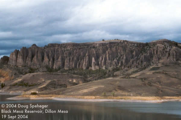
The return portion of our drive took us along the north rim of the
Black Canyon of the Gunnison,
a spectacular sight. East of the canyon was
Blue Mesa Reservoir and the odd Dillon Mesa.
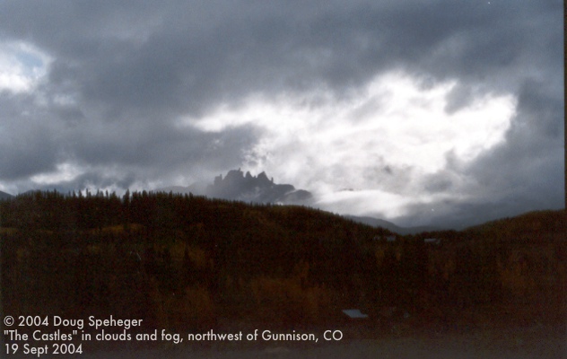
Some sunshine developed, so we returned to the Ohio Creek area to attempt some hiking, but
the earlier rain had made things quite muddy. But here is an
eerie scene of The Castles formation shrouded in low clouds and fog
during our drive back.
The weather complicated things today as moisture was moving into Colorado from Pacific Hurricane
Javier and producing low clouds and occasional rain. So, no hiking today. But we took a
drive through areas north and west of Gunnison where we were able to see some nice colors
in the trees (despite the clouds and poor colors in the sky) such as the varied aspen
colors in the Ohio Creek area on the right and in
this photo.
The return portion of our drive took us along the north rim of the
Black Canyon of the Gunnison,
a spectacular sight. East of the canyon was
Blue Mesa Reservoir and the odd Dillon Mesa.
Some sunshine developed, so we returned to the Ohio Creek area to attempt some hiking, but
the earlier rain had made things quite muddy. But here is an
eerie scene of The Castles formation shrouded in low clouds and fog
during our drive back.
|
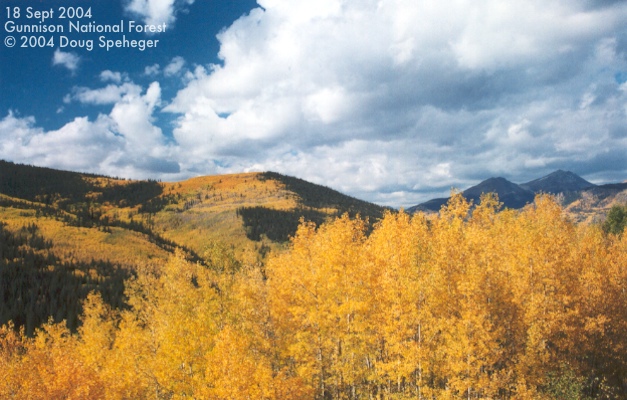
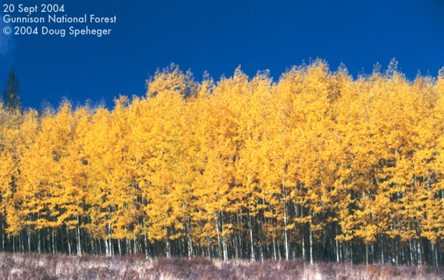
Monday, September 20, 2004 One last day of playing in the mountains east of Gunnison and trying to stay east of the
rain that continued across southwest Colorado. The clouds were in and out, but they did
give us some photo opportunities such as the
aspens in the Gunnison National Forest.
We did one last hike along the Continental Divide in the Saguache Park area, but saw the snow level coming down as seen on the
distant snow-capped mountains. After
the morning and early afternoon in the mountains, it was time to start coming home. (Boo!)
I do have a few more photos that have not been developed yet, but will likely be added
in the future. Also, Kevin Scharfenberg took
this photo of Dave and I waiting for the sun to shine for a photo opportunity on our hike.
One last day of playing in the mountains east of Gunnison and trying to stay east of the
rain that continued across southwest Colorado. The clouds were in and out, but they did
give us some photo opportunities such as the
aspens in the Gunnison National Forest.
We did one last hike along the Continental Divide in the Saguache Park area, but saw the snow level coming down as seen on the
distant snow-capped mountains. After
the morning and early afternoon in the mountains, it was time to start coming home. (Boo!)
I do have a few more photos that have not been developed yet, but will likely be added
in the future. Also, Kevin Scharfenberg took
this photo of Dave and I waiting for the sun to shine for a photo opportunity on our hike.
|