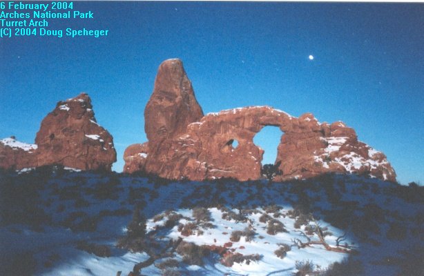
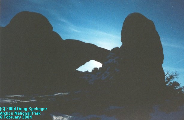
Friday, February 6, 2004
It was a very early flight, but that turned out to be a good thing. Dave picked me up at the Denver airport at around 8 am MST and we hit the road to Utah. There were no weather problems driving through the Continental Divide and we made good time to the Moab area. Since we made good time, we went straight to Arches National Park where we hiked to Delicate Arch for sunset (nice close-up of Delicate Arch). We also tried some moonlit photos of Turret Arch. These photos were taken well after sunset, but with the long time exposure, the moon light gave enough light for photos. Here is a shot of moonlight blocked by the Windows. It was good we were able to do this tonight as clouds made for more difficult photography on Saturday. |
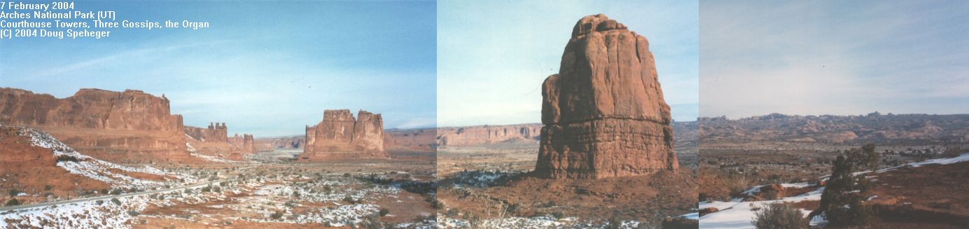
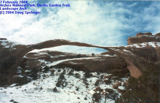
Saturday, February 7, 2004
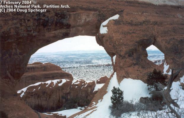
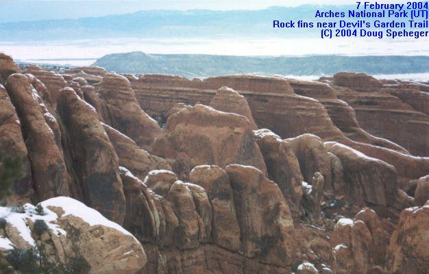
Cloudiness was an issue for photography most of the day (despite the Weather Channel forecasting "sunshine with a few passing clouds.") And recent snows in the area were an issue on our hiking decisions. We started the day in the park viewing the panoramic view from the La Sal Overlook. (yes, I know the foreground and colors don't match well. I'll try to work on that later.) From the vantage point, you could see a number of rock formations through the park. I could not find a name to the closest peak in the photo, but from the left the other close features are the Courthouse Towers, the "Three Gossips" and the Organ. Here is a closer view of the Three Gossips. We started doing the Devils Garden Loop Trail and some of the spur trails to Pine Tree Arch and Tunnel Arch. We hiked to landscape arch, which is one of the longest span arch known with a 300 yard wide span. They say that geologically soon, this arch may break. We also made the spur to Partition Arch (which was a very nice surprise) and Navajo Arch. But the main trail had a problem in one area because of the snow, and we decided to not finish the loop. But we did see a nice winter scene with rock fins near the trail. In the afternoon, we did some exploring along the scenic road just east of Arches National Park, and watched sunset light up Fisher Towers as a gap developed in the cloudiness to the west about 20 minutes before sunset. |
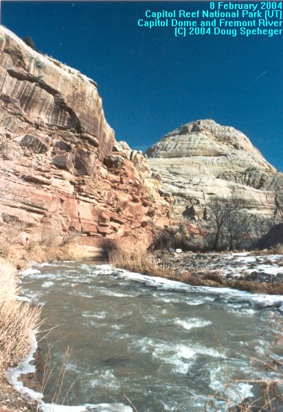
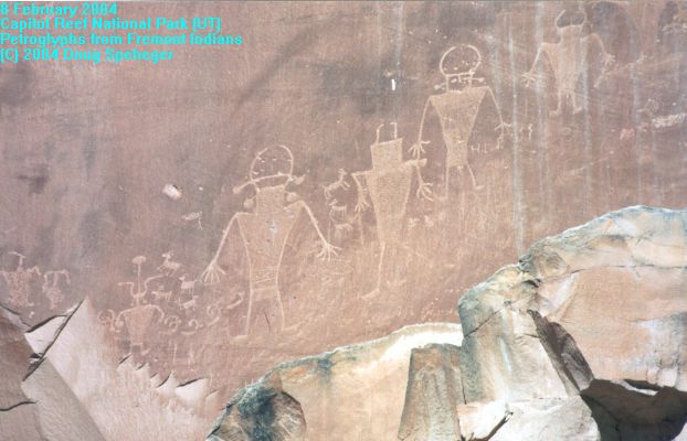
Sunday, February 8, 2004
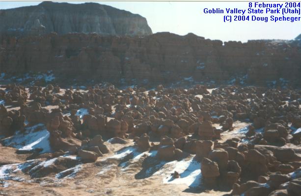
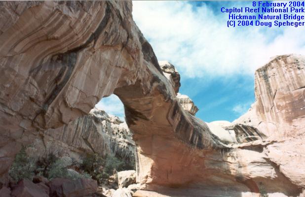
Along the route to Capitol Reef National Park, we made a quick detour to Goblin Valley State Park, which is an intersting place. There are hundreds of rock formations on the valley floor. We went into Capitol Reef National Park, and took the hike to Hickman Natural Bridge near the Capitol Dome and Fremont River. We also hiked part of the trail along a narrow canyon along the Grand Wash trail. There are also some old petroglyphs in the rock in the park. We finished the day enjoying the scenic sunset (albeit cold and very windy) from Sunset Point. |
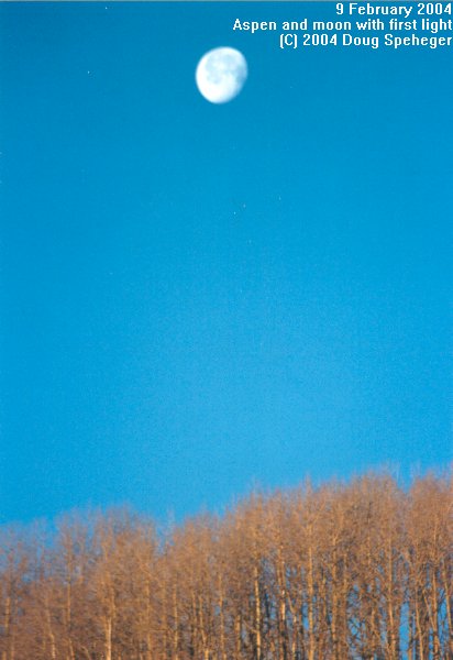
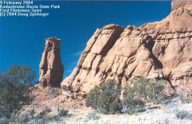
Monday, February 9, 2004
We had a nice, scenic drive through the mountains between Torrey and Kodachrome Basin State park this morning, including the sun's first light on aspen trees with the moon. Kodachrome Basin State Park was a very nice place which features towering sandstone spires and impressive colors. We took the Panorama Trail and Big Bear Geyser Cool Cave Trail passing Fred Flintstone Rock and Ballerina Geyser (shown on right with Dave standing next to it for perspective). OK, it's not an active geyser, but it apparently used to be one which is why the spire is still there. It was a nice hike, especially along the Secret Passage spur, but the trail was close enough to some of the formations that I did not have a lens that was wide-angle enough to capture a lot of it on film. |
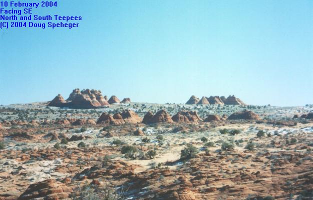
Tuesday, February 10, 2004
Almost the entire day was spent hiking to and exploring the North and South Teepees area of the Paria Wilderness along the Utah-Arizona border. We parked in Utah, then hiked into Arizona to the Teepees formations. They were incredible formations of various sandstone colors (see left) and textures. |
Wednesday, February 11, 2004Another great state park with impressive rock formations and incredible contrast in sandstone colors. But I have not developed those pictures yet. Dave did some wilderness hiking while I went and explored the area near Fire Canyon and Silica Dome once the Las Vegas Police let me through (the road to this trail was blocked for a while as an SUV television commercial was being filmed there). Star Trek fans may recongnize this area as the planet Viridon 3 from the Star Trek Generations movie. Then we drove to Las Vegas for my flight back to Oklahoma. The traffic along I-15 in Las Vegas was a very rude reintroduction to civilazation after a few days in nature. |